
WYCLIFFKIMUTAI
Bridging spatial intelligence and modern web engineering to build systems that transform geographic data into actionable insights.
Where Maps Meet
Modern Software
I'm a Geospatial Data Scientist and Full-Stack Developer with a passion for building systems that bridge the gap between physical location and digital intelligence.
With a background in Geomatics Engineering and advanced analytics, I specialize in creating high-performance web applications that visualize complex spatial data, automate workflows, and drive decision-making for land administration and urban planning.
Field Data
A Toolkit Built for
Complex Problems
Geospatial & GIS
Programming
Web Development
Cloud & DevOps
Data & ML
Surveying
Where I've Built
Real Solutions
Senior GIS Desktop Developer & Front-End Developer
Konza Silicon
- Developed the Ardhisasa QGIS plugin for land parcel management.
- Managed GeoServer cluster and React admin portal handling 10k+ daily records.
- Optimized spatial queries in PostGIS for faster rendering.
Geospatial Engineer
Bell Power International
- Built NextJS web apps and dashboards for 20+ field teams.
- Conducted renewable energy analysis (solar/wind potential).
- Automated data processing pipelines using Python scripts.
Lead Surveyor
KAAD Somalia
- Led topographic surveys for a 309km highway project.
- Established primary control points using GPS RTK/Static methods.
- Processed survey data for engineering design.
Featured
Work
 Web2026
PharmaTrack
Multi-tenant pharmacy management SaaS for Kenya — offline-capable POS with M-Pesa STK push, batch/expiry-aware inventory with FEFO consumption, a PPB controlled-substances register, clinical appointment reminders, and a platform console for billing and tenant operations.
 Web2026
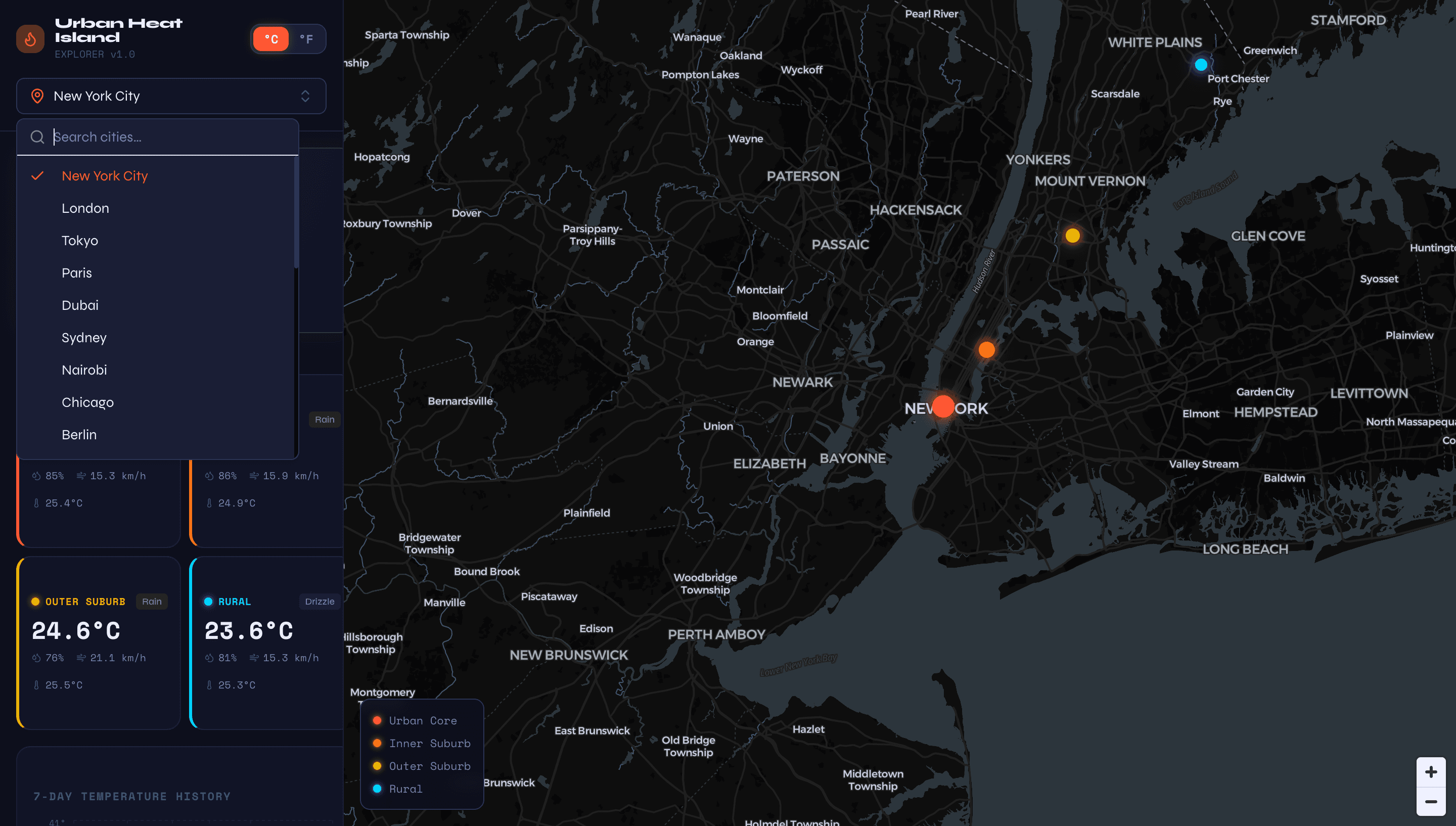
Urban Heat Island Explorer
Live climate dashboard fetching weather data across 4 geographic zones per city in parallel, computing Urban Heat Island temperature deltas with interactive time-series charts and an hourly heat grid.
 GIS2026
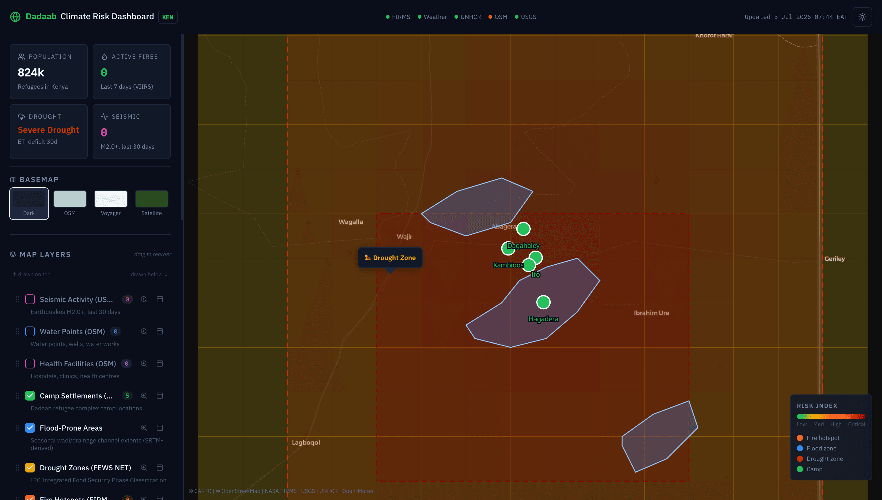
Dadaab Climate Risk Dashboard
Production-grade GIS web app for real-time climate hazard monitoring in the Dadaab refugee complex, Kenya. Integrates 5 live APIs — NASA FIRMS fire detections, USGS seismic data, Open-Meteo weather, UNHCR refugee population, and OpenStreetMap Overpass — with interactive MapLibre layers, QGIS-style attribute tables, and drag-to-reorder layer management.
 GIS2026
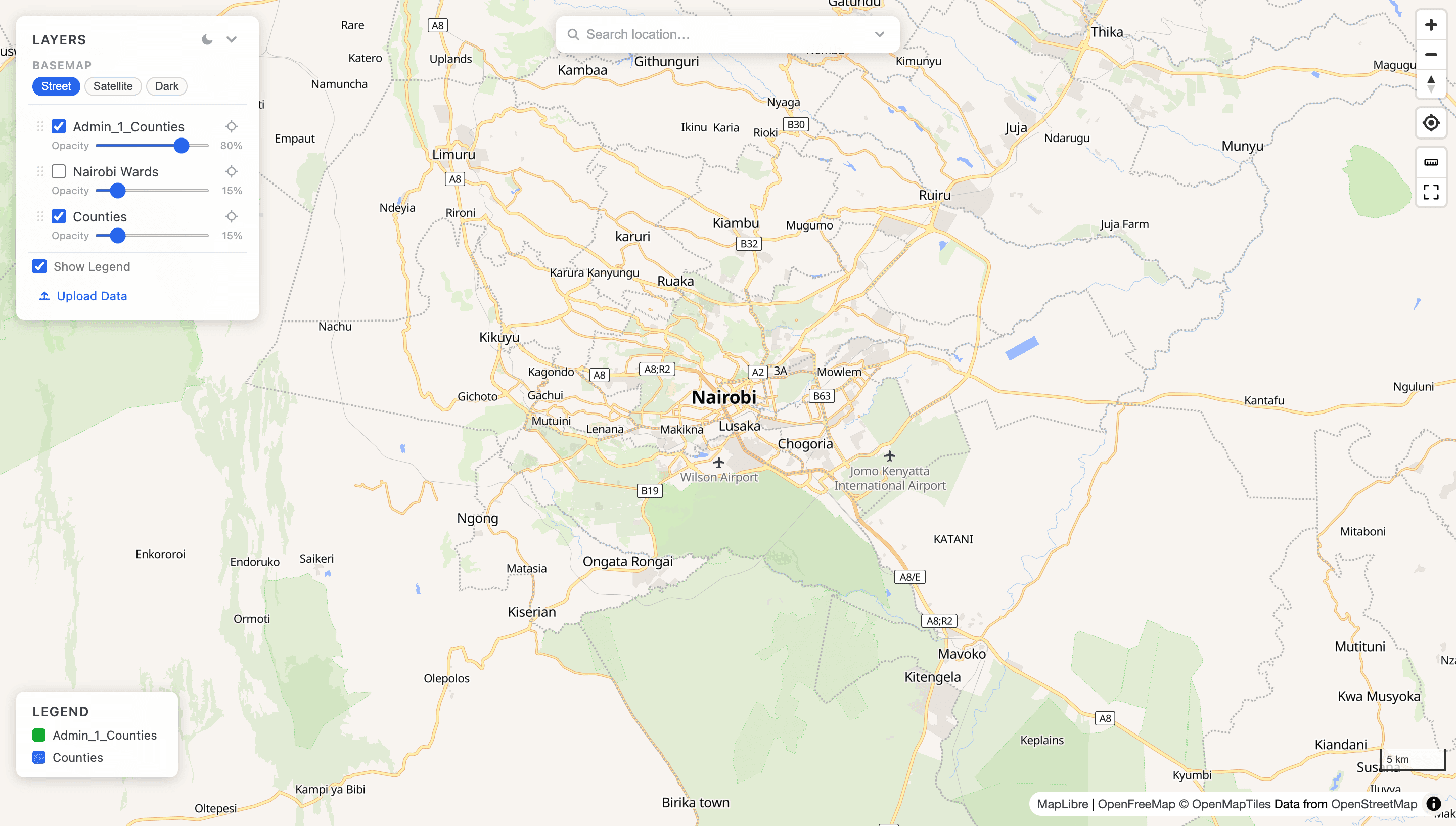
geo-stack — Open-Source Geospatial Infrastructure
Reusable spatial data platform: PostGIS for writes, DuckDB + GeoParquet for analytics, Martin for live vector tiles, PMTiles for static serving, and TiTiler for raster. One codebase, three deployment modes — local M1, Render+Vercel (free), or production VPS with Caddy.
 GIS2026
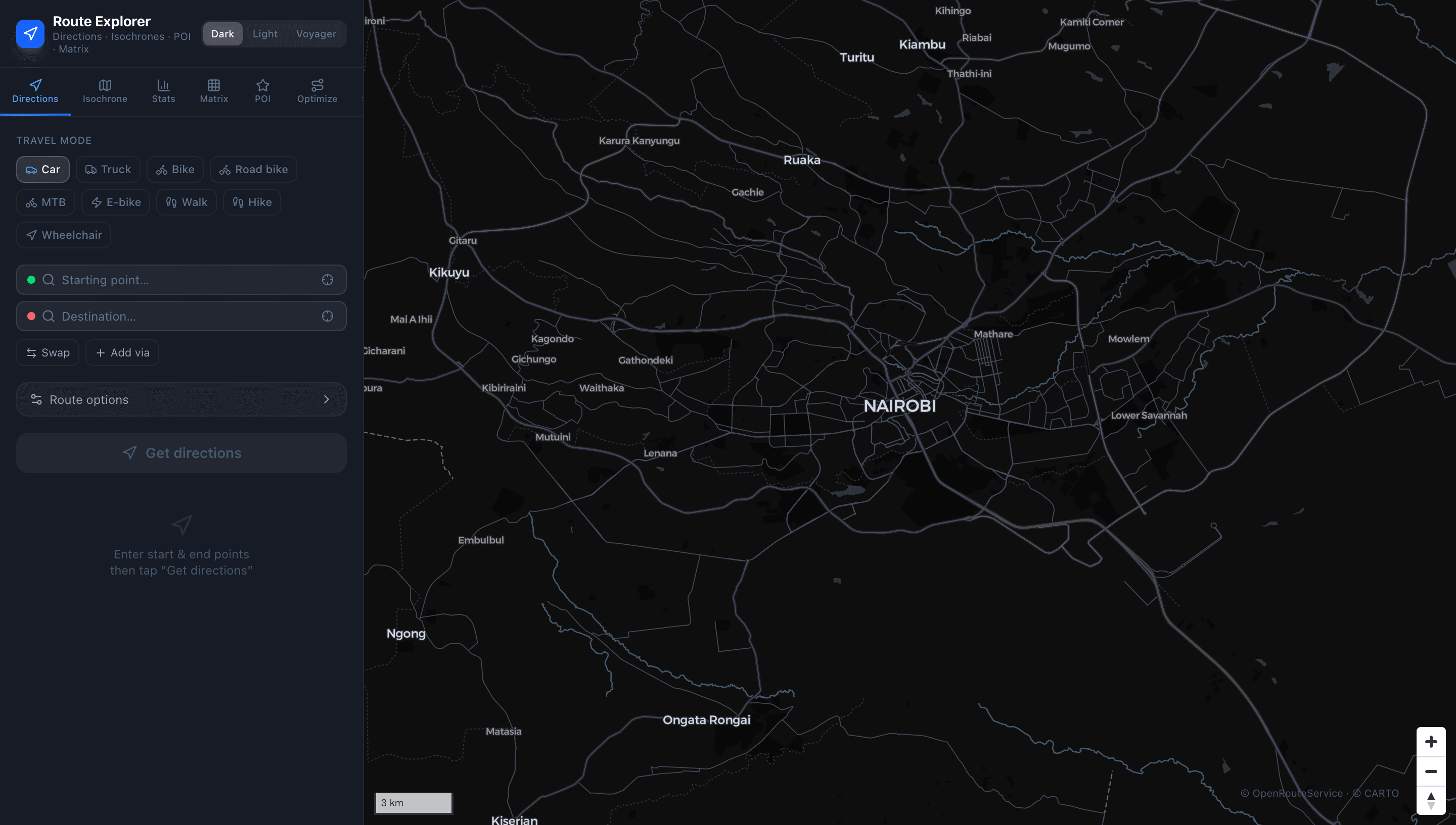
Route Explorer
Full-featured ORS-powered mapping app: multi-waypoint directions with 9 travel profiles, avoid-feature toggles, up to 3 alternative routes, isochrone reachability maps, travel-time matrix, POI discovery, multi-stop route optimisation (VRP/TSP), elevation profiles, and GPX/GeoJSON export.
Academic
Foundation
KCA University
Focus on statistical modeling, big data analytics, and machine learning.
JKUAT
First Class Honours. Specialization in GIS, Geodesy, and Land Information Systems.
Cisco Networking Academy
Network infrastructure, routing protocols, and WAN technologies.
Certifications
Always
Learning
SHEET 06/06Contact
Let's Build
Something Great
Open to geospatial engineering, full-stack development, and interesting collaborations.